Çayırbaşı, Şile — thirteen parcels, one intended estate

A 478-metre strip of land in Şile that its owner, who states it holds all thirteen parcels, intends to consolidate and plan as a single estate. The plan offers two alternative routes: a hotel, or a low-density group of houses.

Explore the land in 3D

The valley, the light, what could stand here

Orbit the real terrain around the thirteen parcels, switch between the capacity tests, and move the sun through a day on the Şile coast.

Terrain: GEDTM30 bare-earth model (30 m) and the Copernicus water mask; parcels: land registry (TKGM); forest: registry parcel 0/809; roads: © OpenStreetMap contributors. Heights ×1.5; storey heights assumed (hotel 4.5 + 3.5 m, houses 3 m); trees and the moonlight after dusk are illustrative; sun position computed for Şile.

  1. Full potential

    What this land can hold

    Follow the valley down to the sea: the land as recorded, the ground beneath it, what the plan allows and what our capacity tests fit. Every figure is read from the survey, the plan notes and the test fits on this page.

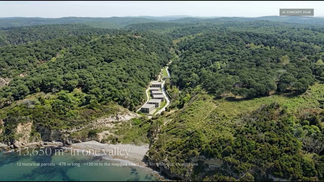
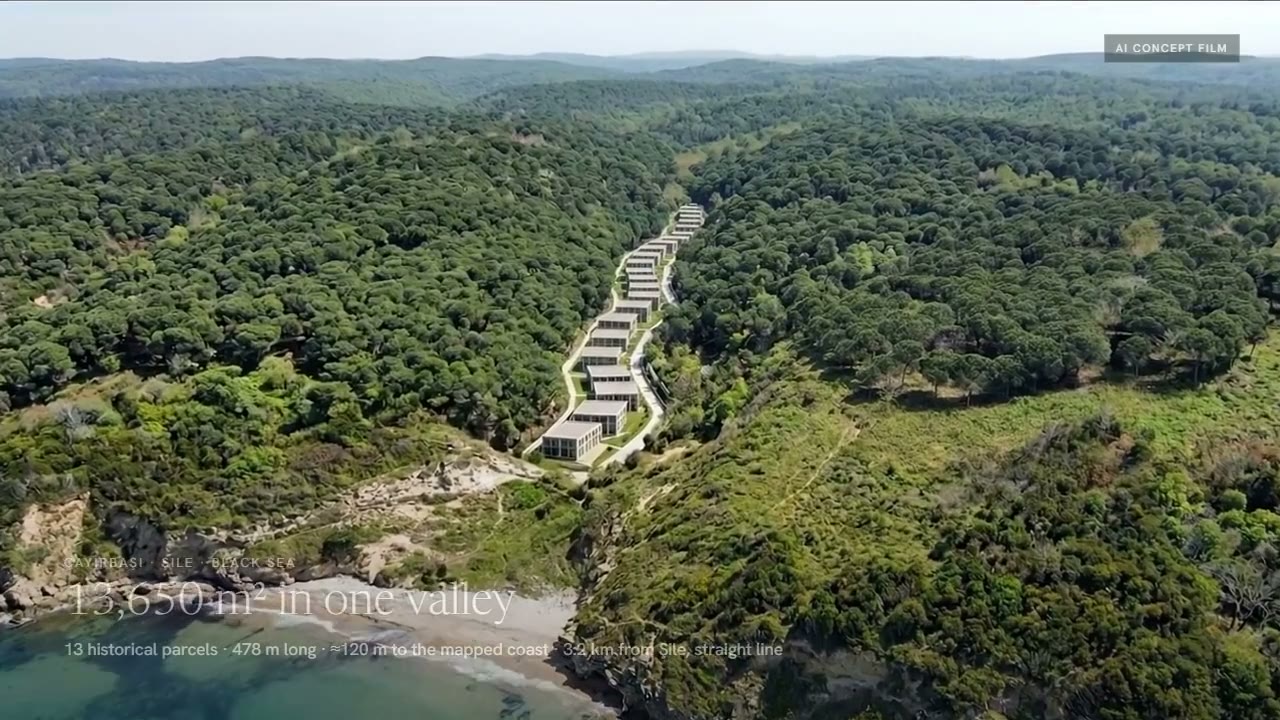
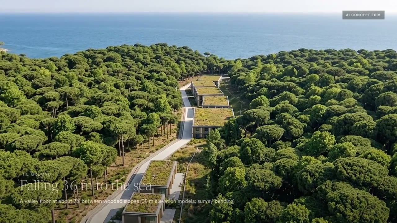
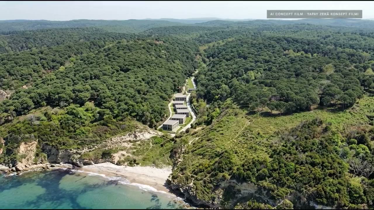
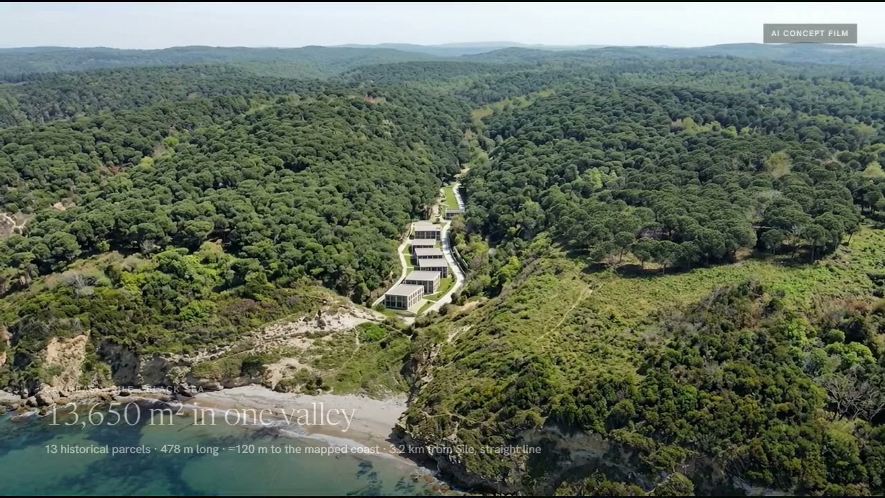
    Concept film (illustrative landscape): from above the sea towards the beach and cliffs, up the wooded valley to low stone-and-timber hotel pavilions, then a walk along the estate drive
    AI concept filmFrom the sea, up the valley: the hotel routeGenerated from our capacity model and drone photographs supplied by the owner (location still being verified); the landscape, coastline and architecture are illustrative. The site's northern tip is about 120 m from the mapped coastline, in a straight line.
  2. Documented land information

    The land, as recorded

    13historical parcels, all recorded as arsa (plot) in the land registry

    13,650m² registered title area

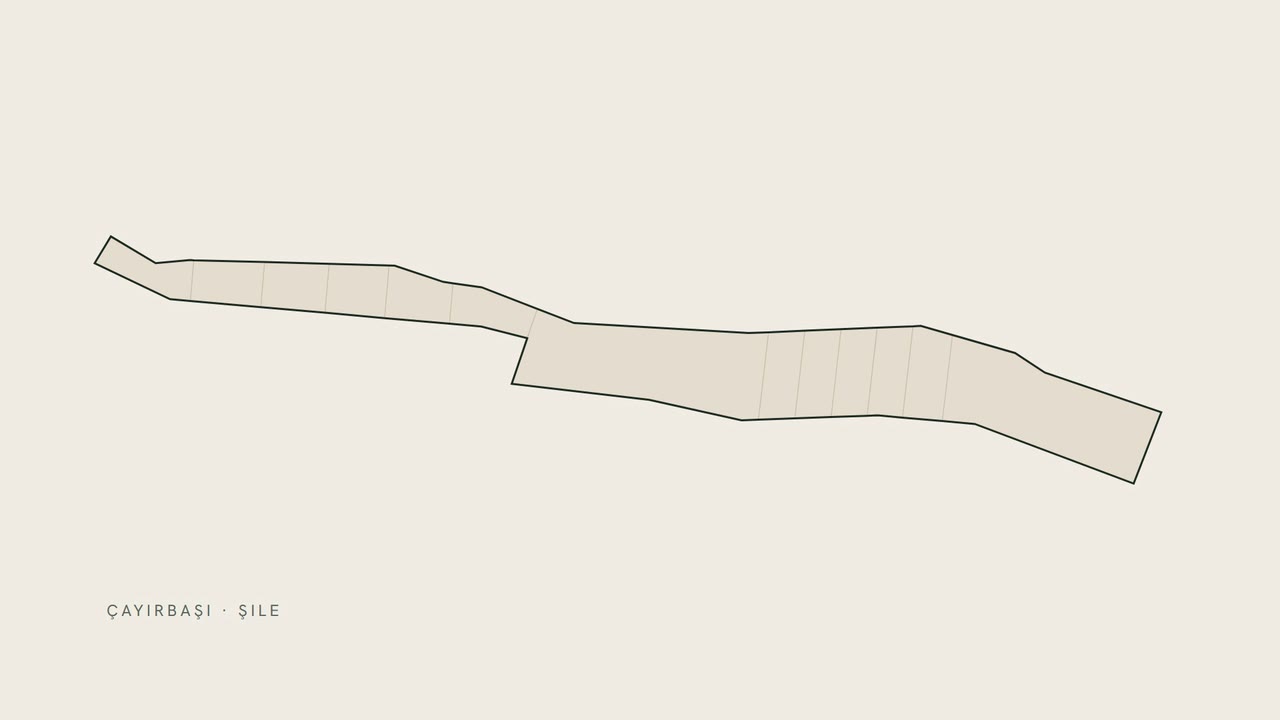
    • ≈478 m long
    • 12–41 m wide
    • about 120 m from the northern tip to the mapped coastline, in a straight line

    Confirmation requiredMerging the parcels into one (tevhit) is the owner's intention; it is not yet registered.

  3. Planning-informed concept

    The ground, falling towards the sea

    ≈36m of fall along the strip, from ≈63 m at the southern tip to ≈27 m at the northern end

    ≈7% average gradient, along the floor of a shallow valley

    • The valley sides stand about 10 m higher, 60 m to either side.

    From 30 m global elevation models: the landform only. Levels and drainage still need a topographic survey.

  4. Conditional calculation

    The slope: a lower floor, not more emsal

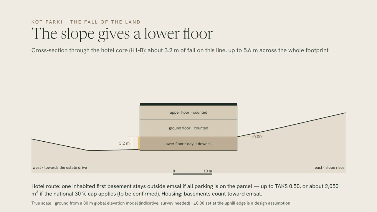
    Kot farkı does not add counted floor area on either route. On the hotel route the plan lets one inhabited first basement stay outside emsal if all parking is on the parcel — and the fall of the ground can bring daylight into it.

    4,090m² lower floor under the hotel buildings (H1-B), ≈1,900 m² of it daylit on the downhill side

    Two readings: the stricter one is the safer basis

    Under the national 30% cap, which plans cannot override

    ≈8,750m² usable

    lower floor outside emsal at most ≈2,050 m², shared with other emsal-free areas, so this total is an upper bound

    If the municipality confirms otherwise

    ≈10,790m² usable

    ≈6,700 m² counted + 4,090 m² lower floor

    Residential route: inhabited basements count toward emsal, so the slope only moves part of the 4,095 m² into a daylit lower floor. Measured on a 30 m elevation model: up to 5.6 m of fall across a building; a survey decides real levels.

    Schematic sectionTwo counted storeysLower floorDaylightUphillDownhill
    Capacity test H1-B · hotel buildings highlighted · schematic section, not to survey levels
  5. Conditional calculation

    What the plan allows: one route or the other

    Tourism route

    6,825m² counted floor area, at most

    Emsal 0.50 · TAKS 0.50 · up to 2 storeys

    or

    Residential route

    4,095m² counted floor area, at most

    Emsal 0.30 · low-density houses

    Alternatives on one parcel: a scheme follows one of them, and the two figures are never added.

  6. Conditional calculation

    What fits: a hotel of pavilions

    ≈90hotel keys in 6 buildings, plus a service building

    ≈6,700 m² counted floor area: 98% of the 6,825 m² tourism ceiling.

    Another layout tested (Hotel core with villa-type guest suites, a route with an explicit condition): about 90 keys, 94%.

    Preliminary capacity test, not a design

    Capacity test H1-B · massing on flat ground · not a design
  7. Conditional calculation

    Or: a single row of houses

    13detached houses with gardens

    ≈3,800 m² counted floor area: 93% of the 4,095 m² residential ceiling.

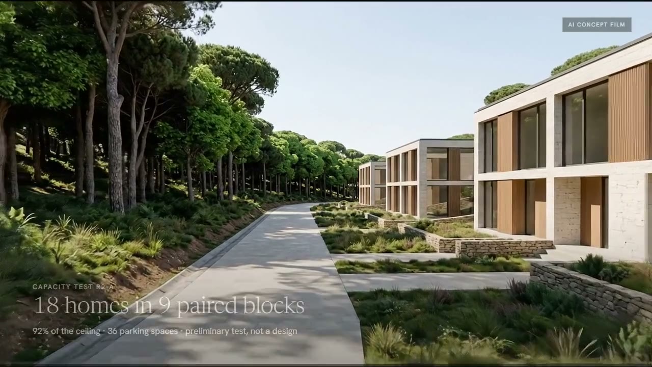
    Another layout tested (Paired houses, a route with an explicit condition): 18 homes, 92%.

    Preliminary capacity test, not a design

    Capacity test R1-A · massing on flat ground · not a design

Ceilings are worked on the 13,650 m² title area, which the owner states is the net area (cessions already made); the consolidation is not yet registered. The two routes are alternatives.

The land at a glance

Six things an investor asks first, each with how we know it.

Location
Çayırbaşı, Şile (İstanbul), Bayramcıl locality
Located from the public land-registry parcel geometry; see the map below. No views are claimed.
Documented land information
Parcels
13 parcels, 535–547
All active and recorded as arsa (plot) in the land registry's public data. Common ownership is the owner's statement.
Documented land information
Area
13,650 m²
Registered total of the historical parcels. The survey outline calculates to ≈13,650 m².
Documented land information
Shape
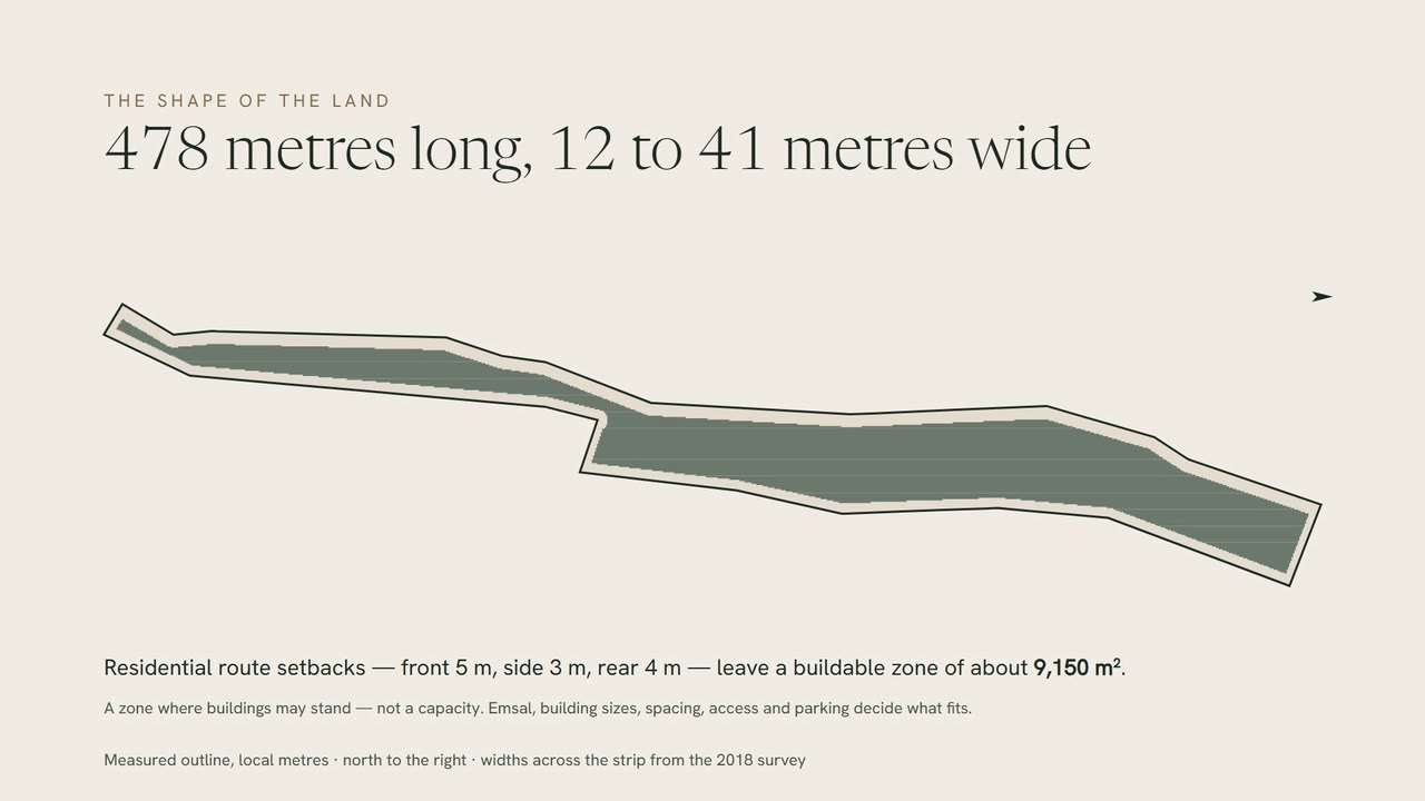
≈478 m long, 12–41 m wide
Narrower over the southern ~200 m (about 12–24 m), wider to the north (30–41 m).
Documented land information
Zoning
TTA — Turizm Tesis Alanı (tourism facility area)
1/1000 Şile Merkez I. Etap implementation plan, amended 15 July 2023 under İBB council decision 818, which lists all 13 parcels. Official imar durumu (zoning statement) still to be obtained. The 1/5000 master plan still shows the earlier tourism designation (TT-2), and an objection round on the plan is awaiting İBB. No lawsuit was found in public records, which cannot rule one out.
Planning-informed concept
Consolidation
Intended, not registered
The owner intends tevhit (merging the 13 parcels into one). The land registry records no consolidation yet.
Confirmation required

Where it is

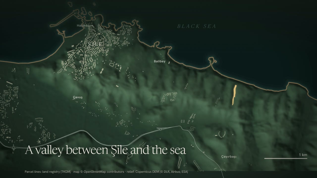
On the Black Sea side of Şile, east of the town centre, with forest on both sides and the mapped coastline about 120 m beyond its northern end, in a straight line.

Film: an aerial concept shot from the sea up the valley; the Şile coast lights up over the terrain and the thirteen parcels draw in; forest surrounds the strip; three neighbouring projects are marked with sourced cards; hotel footprints rise on the strip; a closing card compares the five-star room minimum with our capacity tests
AI concept filmWhere five stars are headingThe coast around the land in just over a minute: Şile, the forest and the sea, the projects arriving next door, and what the plan allows here. The map sequences are drawn from the land registry, OpenStreetMap, the Copernicus elevation model and the figures on this page; the opening and the five-star scene are AI concept footage from our capacity model and the owner's drone photographs.Neighbouring projects: Well World by Esteworld ($180 million, Para Dergi, September 2026); Bilgili Holding's Şile hotel (11,797 m² development area, Bilgili Holding; operator reported as Soho House, Para Dergi, August 2025); Fuzul Topraktan Villa Şile. Locations indicated by the owner and matched to the land registry; independent projects with no affiliation to this land. Star class is granted by the Ministry of Culture and Tourism against its full criteria; the film compares room counts only.

Straight-line distances

Northern tip to the mapped coastline
≈120 m in a straight line
Centre of the land to the Şile reference point
≈3.2 km in a straight line
Southern tip to the D020 road
≈1,200 m in a straight line

These are straight-line measurements, not driving distances or times. They say nothing about legal road access, which still has to be established, and the mapped coastline is not the official shoreline boundary.

Map data © OpenStreetMap contributors (ODbL), extract of 28 September 2026.

The site as measured

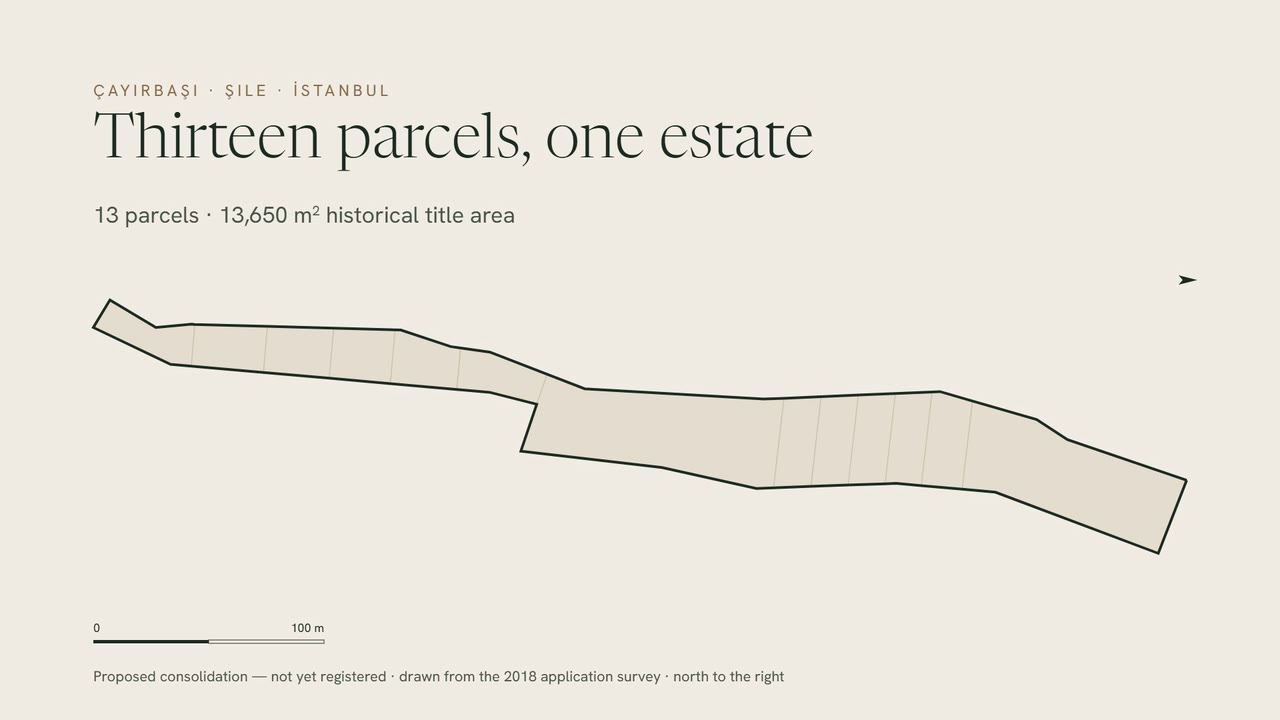
Drawn from the 2018 application survey. Switch between the thirteen historical parcels and the single parcel the owner intends to create.

Measured outline, not georeferenced

Documented land information Thirteen historical parcels, 535–547, as recorded in 2018.

Width along the strip

distance from the southern tip, m

Ground along the strip

distance from the southern tip, m · height above sea level, m

  • ground along the centre of the strip
  • average ground 60 m to either side

Planning-informed concept From global elevation models at 30 m resolution: the land falls about 36 m towards the sea, roughly 7% on average, along the floor of a shallow valley whose sides stand about 10 m higher. This describes the landform only. Levels, drainage and any watercourse will be confirmed by a topographic survey.

Documented land information Geometry transcribed twice, independently, and checked against the survey's own measurements at 51 points (largest difference 5 mm). The shape is fitted to the public land-registry parcel geometry (average difference about 0.4 m, largest about 0.7 m).

Planning-informed concept Surroundings as shown in the 2018 plan annex: forest on both sides, a park at the north end, a car park allocation at the south end and a cadastral road strip along the west. Shown schematically.

Parcels and historical title areas
ParcelTitle area, m²
5353,219
536719
537625
538625
539625
540625
5413,606
542601
543601
544601
545601
546601
547601
Total13,650

What the plan allows

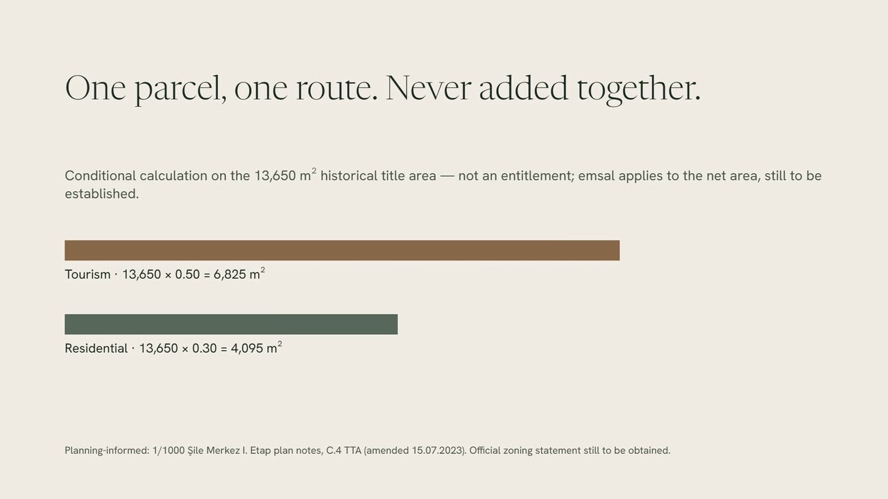
Planning-informed concept The TTA designation offers two alternative routes. On one parcel a scheme follows one of them, and their figures are never added together.

Tourism route

A tourism facility such as a hotel, built as separate, stepped buildings.

Emsal (floor area ratio)
0.50
TAKS (site coverage)
0.50
Storeys
up to 2
Minimum parcel
2,500 m²
Minimum frontage and depth
20 m
Massing
Fragmented and stepped; no single monoblock
Independent units
None: no separately owned homes or shops
Residential route

Low-density houses in separate blocks with gardens.

Emsal (floor area ratio)
0.30
Minimum plot on subdivision (ifraz)
350 m²
Setbacks
front 5 m, side 3 m, rear 4 m
Building size
6–20 m × 7–20 m
Storeys
2, under the low-density rules (scope being confirmed)

Emsal is applied once, to the net area

The ratio applies to the net parcel area that remains after road or public allocations. The owner states those cessions have already been made, so the title area is the net area; the plan records show no road, park or car park on the parcels. It is a total for all counted floors, not a figure per floor.

Conditional calculation

Arithmetic on the 13,650 m² title area, which the owner states is the net area. These are ceilings, not a permit: the zoning statement confirms them.

Tourism route
13,650 × 0.50 = 6,825 m²
Residential route
13,650 × 0.30 = 4,095 m²

One route or the other. The two results are never added.

Why not a hotel with homes for sale?

On a single parcel the tourism route allows no independent homes, and the residential route does not provide for a hotel. Combining them conflicts with an identified rule.

The land in motion

Five AI concept films of what the land could become, followed by four short explanations drawn directly from the measured survey, the elevation model and the plan figures on this page.

Main film, about two minutes: from the sea up the valley, through animated plans of the parcels, the strip's width and the slope, to the hotel and residential routes, ending on a card of figures
AI concept filmThe whole story in two minutesLocation, the thirteen parcels, the shape and fall of the land, what the plan allows on each route, and both routes seen on the ground. The explanatory sequences are drawn from our measured data; the landscape and architecture sequences are AI concept footage from our capacity model and the owner's drone photographs (location still being verified). Every figure comes from the data on this page.
Concept film with captions: from the sea up the valley to a hotel of low pavilions, ending on a card with the land area, the tourism ceiling and the capacity test
AI concept filmThe hotel route, from the seaSea, valley and an arrival on foot, stitched into one film with the figures behind it: the 13,650 m² title area, the tourism ceiling and the H1-B capacity test. Generated from our capacity model and drone photographs supplied by the owner (location still being verified); architecture and planting are illustrative.
Concept film with captions: from the sea up the valley to a single row of two-storey villas, ending on a card with the residential figures
AI concept filmThe residential route, from the seaThe same coast and valley with the residential capacity test: thirteen detached two-storey houses in a single row, captioned with the residential ceiling and the test's figures. Generated from our capacity model and drone photographs supplied by the owner (location still being verified); architecture and planting are illustrative.
Concept film with captions, a route with an explicit condition: a drone glide down the valley over single-storey suites towards two-storey hotel buildings
AI concept filmHotel core with villa-type suites (conditional route)The second hotel layout tested, a route with an explicit condition: single-storey villa-type suites near the arrival and two-storey buildings further up the valley. Whether villa-type suites count as hotel accommodation, with no separate sale, needs municipal confirmation. Generated from our capacity model and drone photographs supplied by the owner (location still being verified); architecture and planting are illustrative.
Concept film with captions: an eye-level walk past two-storey paired house blocks with gardens and low stone walls, ending on a card of residential figures
AI concept filmPaired houses (conditional route)The third residential layout tested: eighteen homes in nine two-storey paired blocks along the drive. Paired houses are a conditional route: whether the low-density block rules allow them here needs municipal confirmation. Generated from our capacity model and drone photographs supplied by the owner (location still being verified); architecture and planting are illustrative.
Film: the thirteen parcels drawing in and merging into one outline, captioned as not yet registered
Thirteen parcels, one estateThe parcels draw in one by one as the title area adds up to 13,650 m², then merge into the outline the owner intends to register.
Film: a measuring line moves along the strip showing its width, then the area inside the residential setbacks appears
The shape of the landA line travels the 478 m strip reading its width, then the residential setbacks reveal where buildings could stand.
Film: the two TTA routes compared, with the conditional calculation shown as bars
Two routes, never addedThe tourism and residential routes side by side, and the conditional arithmetic that gives a sense of scale.
Film: a true-scale cross-section through the hotel core; the ground line draws, two storeys rise, then a daylit lower floor appears on the downhill side
The slope gives a lower floorA true-scale section through the hotel core, drawn from the elevation model: two counted storeys set at the uphill edge and the lower floor that the cross-fall opens to daylight.

The four films below are motion graphics generated from the project data. The five concept films above are AI-generated from our capacity model, with drone photographs supplied by the owner (location still being verified) as look references. None of them is a photograph of the site or of a built scheme, a rendering of an approved design, or an approval.

Ways the estate could be planned

Four routes are being worked through with their conditions. Choose one to see what it means and how it could sit on the land.

Hotel

Legal screening: Supported route, subject to conditions

What it is
A single hotel made of low, separate pavilions of up to two storeys, with reception and restaurant as part of the hotel.
Ownership and operation
One owner and one operator. Rooms are not sold individually and there are no independent units.
Legal screening
The tourism route sets the figures directly, and a hotel of pavilions is its most literal fit.

Key conditions

  • Emsal 0.50 and TAKS 0.50 on the 13,650 m² net area stated by the owner
  • The plan notes give no setbacks for tourism use; the İstanbul zoning regulation's defaults (front 5 m, side and rear 3 m) are used here and must be confirmed
  • Parking and the hotel's classification to be agreed with the authorities
  • All the open steps listed below
Preliminary capacity test — massing only, not a design or permit drawingTest fit revision T0.2
Loading the drawing…

Preliminary capacity test on the 13,650 m² title area: massing only, not a design or a permit drawing. Contours from the GEDTM30 30 m model (indicative; a survey decides levels). Storey heights assumed: hotel 4.5 + 3.5 m, houses 3 m.

Also being screened

Further routes are under study and are not presented here:

  • Villa-style hospitality estate
  • Apart-hotel
  • Low-rise apartment buildings
  • Villas and low-rise apartments together

Hotel plus independent homes — under investigation

On one parcel this conflicts with an identified rule. A structure with separate parcels is being investigated; it is not offered as an option.

What has to happen first

Every route depends on the same steps. None of them is complete yet.

  1. Official zoning statement

    An imar durumu for the consolidated parcel, confirming the TTA designation shown in the municipal GIS.

    Open
  2. Registered consolidation

    Tevhit of the 13 parcels recorded at the land registry. A tourism scheme needs at least 2,500 m² and 20 m frontage and depth.

    Open
  3. Legal road access

    The 2018 record states that no building permit can be issued until a cadastral road connection exists.

    Open
  4. Forest opinion

    An opinion from the forest administration for parcel 535 and the southern parcels 542–547. The digital master plan lists forest areas there, while the forest administration’s own stand map shows the whole strip as a non-forest opening; the legal forest cadastre decides.

    Open
  5. Public strips

    Cessions are complete according to the owner; the small strips of public land to be added to the plot (ihdas), if pursued.

    Open
  6. Ground study

    An approved geological and geotechnical study.

    Open
  7. Preliminary project

    Approval of the avan proje (preliminary design) with the related level and alignment documents.

    Open
  8. Parcellation check

    Confirmation of whether a parselasyon (land readjustment) is needed before the parcels can be consolidated.

    Open
  9. Drainage and watercourse

    A topographic survey and an İSKİ/DSİ enquiry on whether the valley floor carries a watercourse, protection band or flood risk that would shape the layout.

    Open
  10. Shoreline band

    Confirmation of the approved shore edge line (kıyı kenar çizgisi) near the northern tip, and that the 100 m coastal band in which building is restricted does not reach the parcels.

    Open
  11. Plan status

    Confirmation that the new implementation plan started in November 2025 for parts of Çavuş, Balibey and Çayırbaşı leaves the site’s designation unchanged, and the outcome of the objection round awaiting İBB.

    Open

Looking for the right partners

We are opening conversations about how the estate is taken forward. There are no fixed terms yet; we would rather shape them together with people who know this kind of land.

Start a conversation
Investors
Capital for land that is still before its permits, alongside the owner.
Development partners
Experience in planning approvals, design and delivery of low-density schemes.
Hotel operators
Operators interested in a hotel of low pavilions in Şile.

How this page was made

  • The 2018 cadastral record and application survey (held by the owner), transcribed twice and checked against the survey's measurements.
  • Public land-registry (TKGM) parcel data, checked on 11 October 2026: all 13 parcels active, recorded as arsa (plot), total 13,650 m², no consolidation recorded.
  • A compilation of the notes of the 1/1000 Şile Merkez I. Etap implementation plan, amended 15 July 2023.
  • Screenshots of the municipality's planning GIS.
  • Preliminary capacity test fits drawn on the measured outline.

This page is a concept and preliminary feasibility study, not a permit, survey certificate or professional opinion.

Contact

Talk to us about Çayırbaşı

Tell us who you are and what interests you: investing, developing or operating a hotel. The details behind this page are best discussed in person.

Let us know a day and time that suits you for a visit.

Interested in

“Send via email” delivers your message straight to our team; the WhatsApp option opens it ready to send in your app. This site does not store form data.